Interactive Equivalent Latitude Map
November 9th, 2015
A few years ago, I read Guns, Germs and Steel by Jared Diamond, which gives a deterministic explanation of why civilizations have progressed the way they have. Among the factors that Diamond cites as determining the fate of a societies is latitude(how far North or South a location is). Locations with equal latitude have equal length days and often similar climates, suitability for crops, etc...
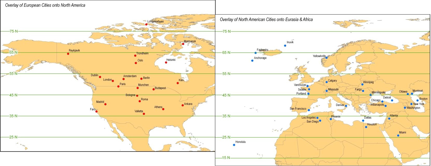
This map, originally created by Beardsley Klamm, has been circulating around the internet and shows some surprising comparisons between where European and North American cities in terms of latitude(eg: Rome is North of Denver).
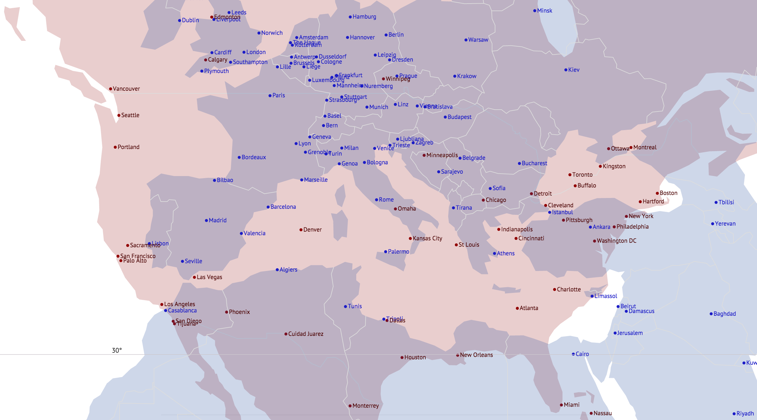
Shown below is an interactive world map with two layers, one that is static and one that can be moved and zoomed. The other map responds to these interactions such that latitudes on both maps line up. Similar to the map above, there are surprises in how latitudes compare. However, some interesting similarities can be seen, eg: the wine grape growing regions of California, South Africa, Australia and The Mediterranean have similar latitudes.
Drag and use mouse zoom to move map layers. Zoom in further to see city labels.
Compare Opposite Hemispheres
·
Move Blue Layer